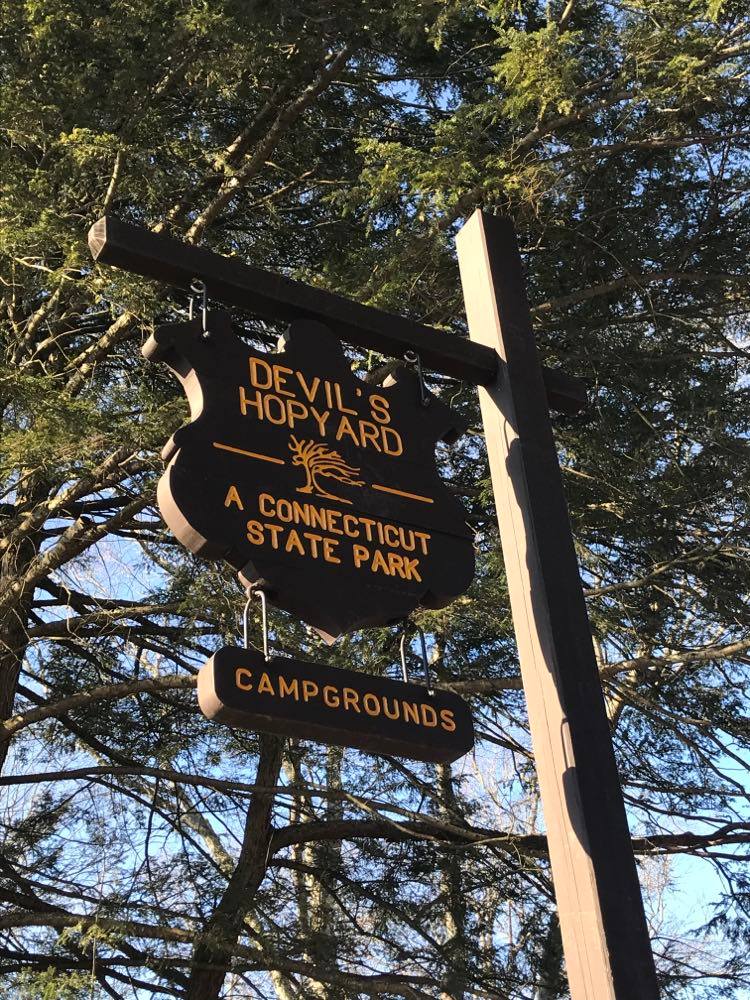
Devil’s Hopyard State Park is one of Connecticut’s best-kept secrets.
This beautiful park is located at 366 Hopyard Road in East Haddam, Connecticut, and boasts over 860 acres of amazing scenery, as well as one of the most beautiful waterfalls in Connecticut.
There are many features of this park that add to its beauty and uniqueness, including areas of glacial plucking and differential weathering on its boulders and pegmatite outcrops along the trails.
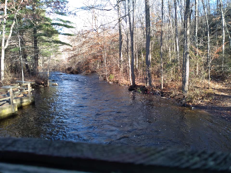
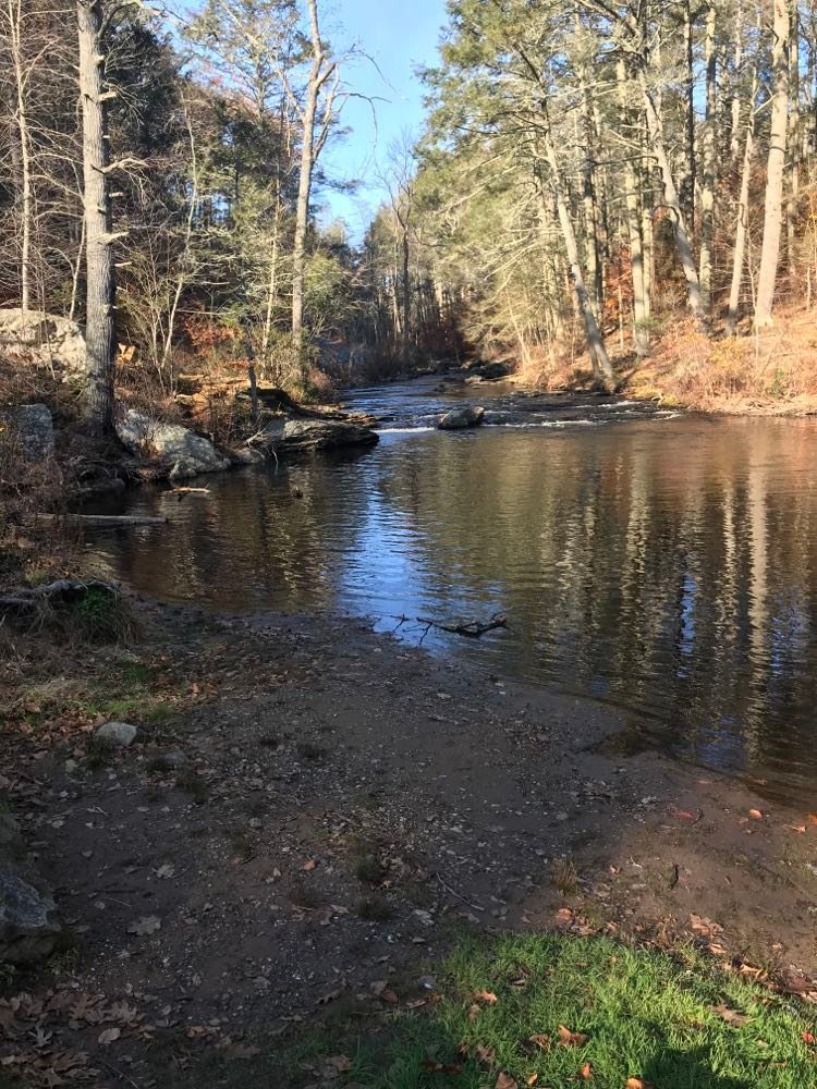
The moment you arrive on Hopyard Road from 82 East, you begin to get a feel for how beautiful this park is.
You may even decide to stop before you even get to the main entrance, as there are some beautiful photography spots along 8 Mile River.
Let’s take a look at what you can expect at Devil’s Hopyard State Park.

Devil’s Hopyard State Park history
Devil’s Hopyard State Park has a rich history that dates back to the revolutionary war when Chapman Falls powered Beebe’s Mills.
It is recorded that in 1775 the townspeople of East Haddam destroyed the mill of Dr. Abner Beebe’s due to his loyalty to England.
It is said that Abner Beebe was tarred and feathered by an angry mob and this was fuel for England’s suppression of the Rebellion.
The mill was eventually rebuilt and remained in operation until the mid-1890’s.
So, why is is called Devil’s Hopyard?
The name Devil’s Hopyard actually has nothing to do with the history of the park, but rather the geographical features.
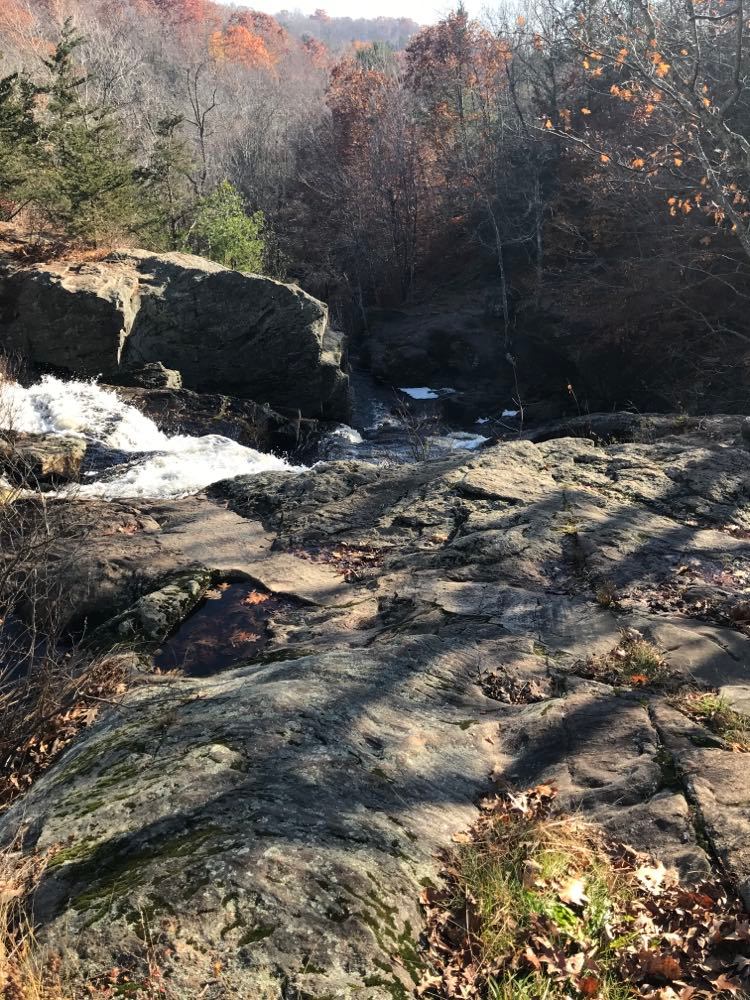
The pothole stone formations near the bottom of Chapman Falls were believed to be made by Satan’s tail burning holes in the stones.
Before advanced geographic studies were a thing, supernatural explanations of the perfectly cylindrical holes were widely accepted.
Another explanation for the park’s name is that a farmer named Dibble once used the land to grow hops to brew beer and that eventually “Dibble’s Hopyard” grew into “Devil’s Hopyard”.
While there were hop gardens in this region at various points in time, there is no record of anyone by the name of Dibble owning any property here.
Activities at Devil’s Hopyard State Park in East Haddam, Connecticut
There is a lot to do at Devil’s Hopyard. Whether you are looking for a nice place for a quick picnic or you’re looking to spend the day hiking, this state park has something for you.
Below, we give you the rundown on exactly what there is to do at Devil’s Hopyard.
Picnicking
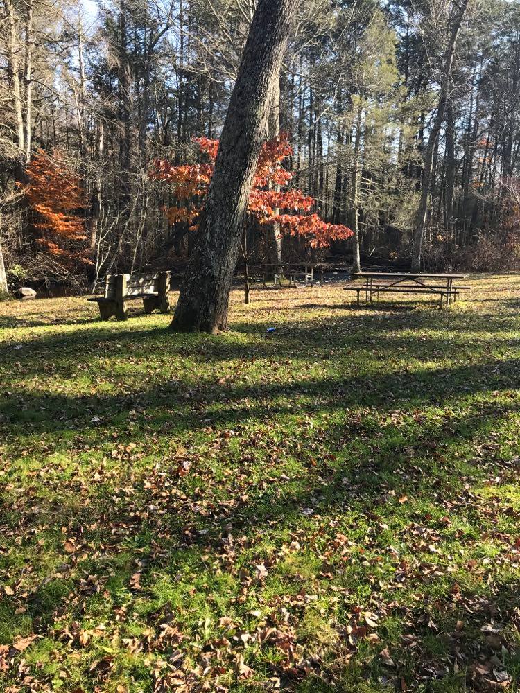
Devil’s Hopyard is a popular place for picnicking. There are a few different picnic areas, some accommodating just a few small families and some for larger parties.
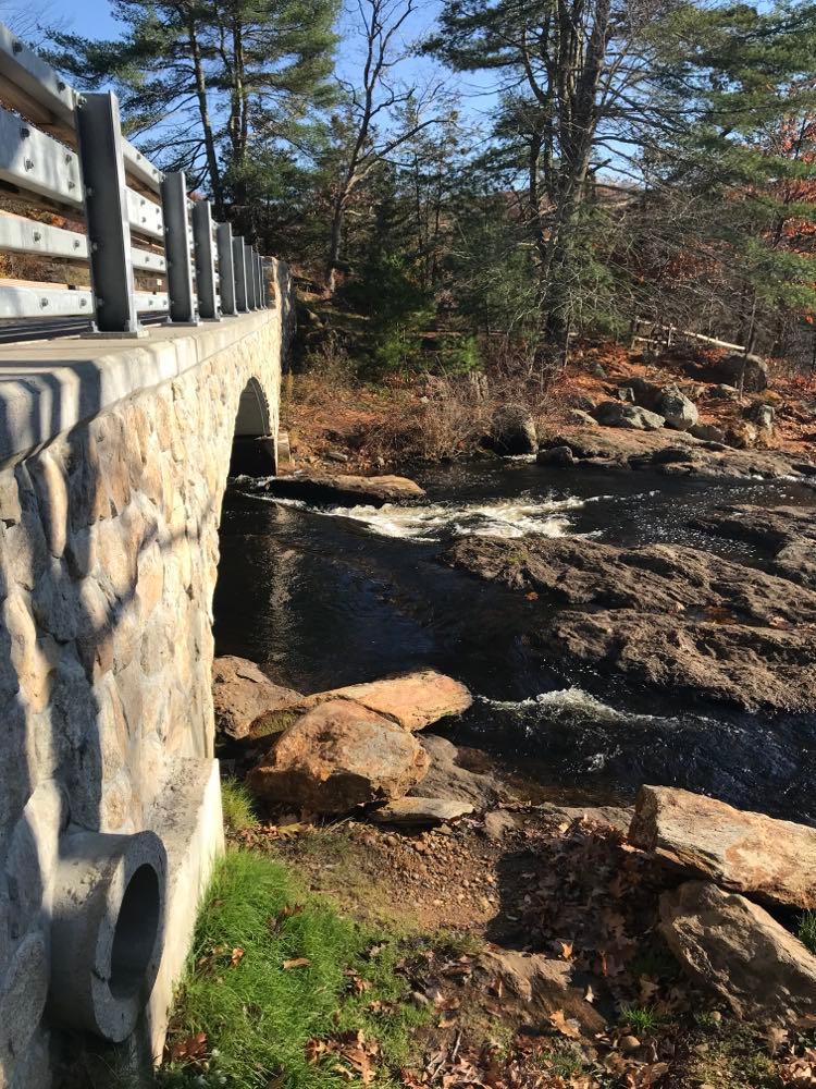
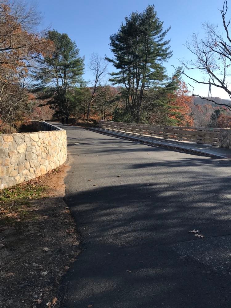
The main picnic area is located alongside a narrow portion of 8 Mile River where a covered bridge crosses.
From the picnic area, it’s a short walk to Chapman Falls.
Camping
If you are looking for a place to camp in Connecticut, there are few places better for this than Devil’s Hopyard.
This campground features 21 wooded campsites and is located just a few steps away from the top of Chapman Falls on Foxwood Road.
The rates at this campsite are reasonable for both Connecticut residents and out-of-towners – $14/night and $24/night.
Click here for a map of the Devil’s Hopyard State Park Campground.
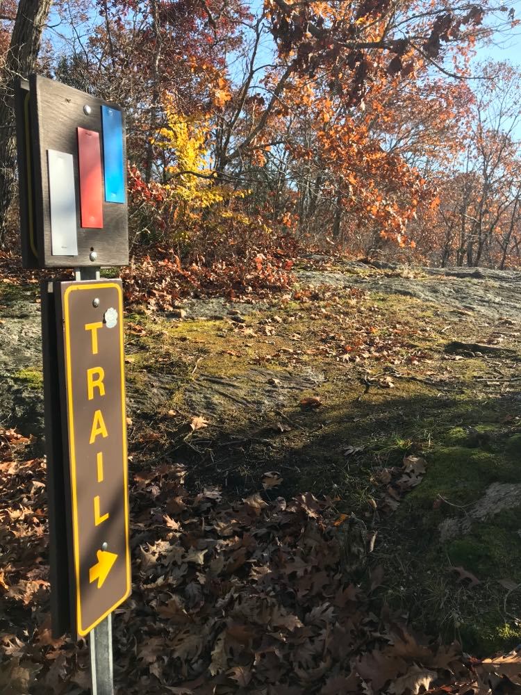
Hiking trails
If you are looking for a relatively easy and extremely beautiful hike, Devil’s Hopyard has you covered.
There are a total of 8 hiking trails to choose from:
- Blue and Yellow Loop
This is a 3.6 mile hike and is considered easy. The trail starts at the south edge of the park, along Mitchell Road.
- Vista and Devil’s Oven via Orange Trail Loop
This is 2.2 mile hike and is considered moderate difficulty. The trail starts at the main parking lot.
It takes you past the Devil’s Oven and back.
- Vista Trail and Devil’s Oven Loop
This is a 2 mile hike and is considered moderate in difficulty. The trail starts at the main parking lot and takes you over the covered bridge, to the Devil’s Oven, and back.
- Chapman Falls Loop
This is a 0.4 mile hike and is considered moderate difficulty. The trail starts at the parking lot at the main entrance.
This trail will take you alongside Chapman Falls. *
- Millington Trail Loop
This is a 2 mile hike and is considered moderate difficulty. The trail starts just above the parking lot at the main entrance.
- White and Orange Blaze Loop
This is a 2.6 mile hike and is considered moderate difficulty. The trail starts just beyond the covered bridge near the main entrance.
- Witch Hazel Trail via Millington Loop
This is a 4.5 mile hike and is considered easy. This trail starts at the top of Chapman Falls and is accessed from Foxtown Road.
- White and Orange Blaze Short Loop
This is a 1.8 mile hike and is considered easy. This trail starts at the covered bridge near the main entrance of the park.
Fishing
The 8 Mile River is the body of water that is located in Devil’s Hopyard. It is designated as a National Scenic and Wild River by the United States Forest Service.
From pickerel to brook trout, there is some great fishing here.
Birding
So many beautiful birds are native to Connecticut and Devil’s Hopyard is a great place to hike peacefully and see some spectacular birds.
What birds can you expect to see? Well, that depends on a lot of factors – the weather (current and over the course of the year) being one of them.
Here are just a handful of birds you might see here:
- Northern Harrier
- Belted Kingfisher
- Prothonotary Warbler
- Red-eyed Vireo
- Scarlet Tanager
In my experience, the best birding takes place starting in the late spring and continuing throughout the summer.
Swimming
I never enjoy being the bearer of bad news, however, swimming is not allowed at Chapman Falls, nor in any of the streams throughout the park.
This does not mean you can’t dip your feet in the water to cool off or hop across some rocks – just don’t swim.
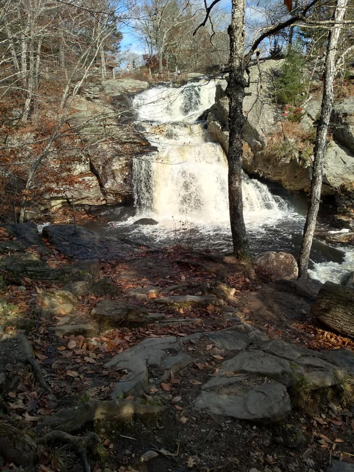
Chapman Falls: The Devil’s Hopyard State Park waterfall
Chapman Falls is one of the most beautiful waterfalls in Connecticut and it’s located in Devil’s Hopyard State Park.
Water drops from over 60 feet at the falls and you will get a beautiful view of cascades and rock scrambles.
Though swimming is not technically allowed in Devil’s Hopyard, you will find that swimming does take place at Chapman Falls.
There have been numerous injuries, and even some deaths, from swimming in New England’s waterfalls over the years.
So, if you want to be safe, we recommend dipping your feet in only. There are even some amazing wading pools toward the top of the falls.
Directions to Chapman Falls
If you want to bypass all the other activities at Devil’s Hopyard State Park and go straight to Chapman Falls, here is how to do it:
From Hopyard Road: Chapman Falls can be accessed from the main picnic area/covered bridge area at the main entrance of the state park.
From the parking lot, you have the choice of following a path upstream through the woods and up a steep incline or a man-made path.
From Foxtown Road: On Foxtown Road, just off Hopyard Road, there is a small parking lot immediately prior to the 8 Mile River bridge.
Park here and cross the street to arrive at the top of Chapman Falls. You will have a couple of different choices of trails to take that run the length of the falls.
You will also find wading pools at the top of the falls.
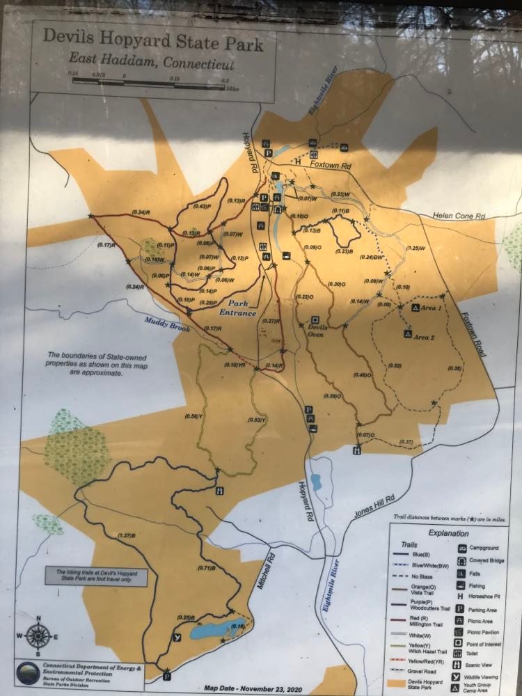
Devil’s Hopyard map & directions
Devils Hopyard is located off Route 82 in East Haddam. The main roads that connect to Route 82 are:
- Interstate 395 (exit 7(
- CT Route 9 (exit 80 west)
- I-91S (exit 22)
The address of the park: 366 Hopyard Road in East Haddam, Connecticut, 06423.
Where is the Devil’s Hopyard main entrance
The main entrance of Devil’s Hopyard State Park is located on Hopyard Road, about 1/8 mile south of Foxtown Road.
How far is Devil’s Hopyard State Park from New York City?
Devil’s Hopyard State Parks is approximately 115 miles from the Center of New York City.
Travel time from New York City to Devil’s Hopyard is between 2 and 2.5 hours.
Many New Yorkers consider this a reasonable distance to drive for the natural beauty this park provides.
Other Devil’s Hopyard State Park Information
Are dogs allowed?
Dogs are welcome (leashed) on the trails and in the picnic areas, however, no dogs are allowed at the campgrounds.
When does Devil’s Hopyard close?
The hours of this park are 8 am to sunset.